
Historically, certain directions have special significance and may be considered auspicious, even sacred. For thousands of years these directions, which include north, south, east, and west – the cardinal directions, the directions in which the sun rises and sets on the summer and winter solstices, and the directions of extreme motion of the moon (lunar standstills), have influenced the design and alignment of churches, temples, cities, and other places of importance throughout the world.
Sacred Directions is an Mac OS archaeoastronomy app that displays these directions on a satellite image at any location for the purpose of understanding a site in terms of its relation to the heavens and to other sites. Sacred Directions AR is a iOS app that displays these same directions in a augmented reality (AR) view as seen through the device’s camera.
How to Use
Sacred Directions AR can be used anywhere as it does not require an Internet connection. Hold it up and rotate in a circle to find the cardinal directions, summer and winter solstice sunrise and sunset directions, the summer and winter major and minor lunar standstill moonrise and moonset directions. The time slider allows you to view these directions now or anytime within the past 170,000 years.

Site Example
Xochicalco is an ancient archaeological site about 2-1/2 hours south of Mexico City that is thought to have been built around 750 CE. Click here for a nice description of the site and a possible reason why it was abandoned. The following screenshots illustrate the use of Sacred Directions AR at Xochicalco.
From the visitor center one enters the site from the south. Continuing up the mountain path one reaches the Grand Pyramid and Plaza of the Two Glyphs (left). Screenshot of AR view of the Grand Pyramid (right).
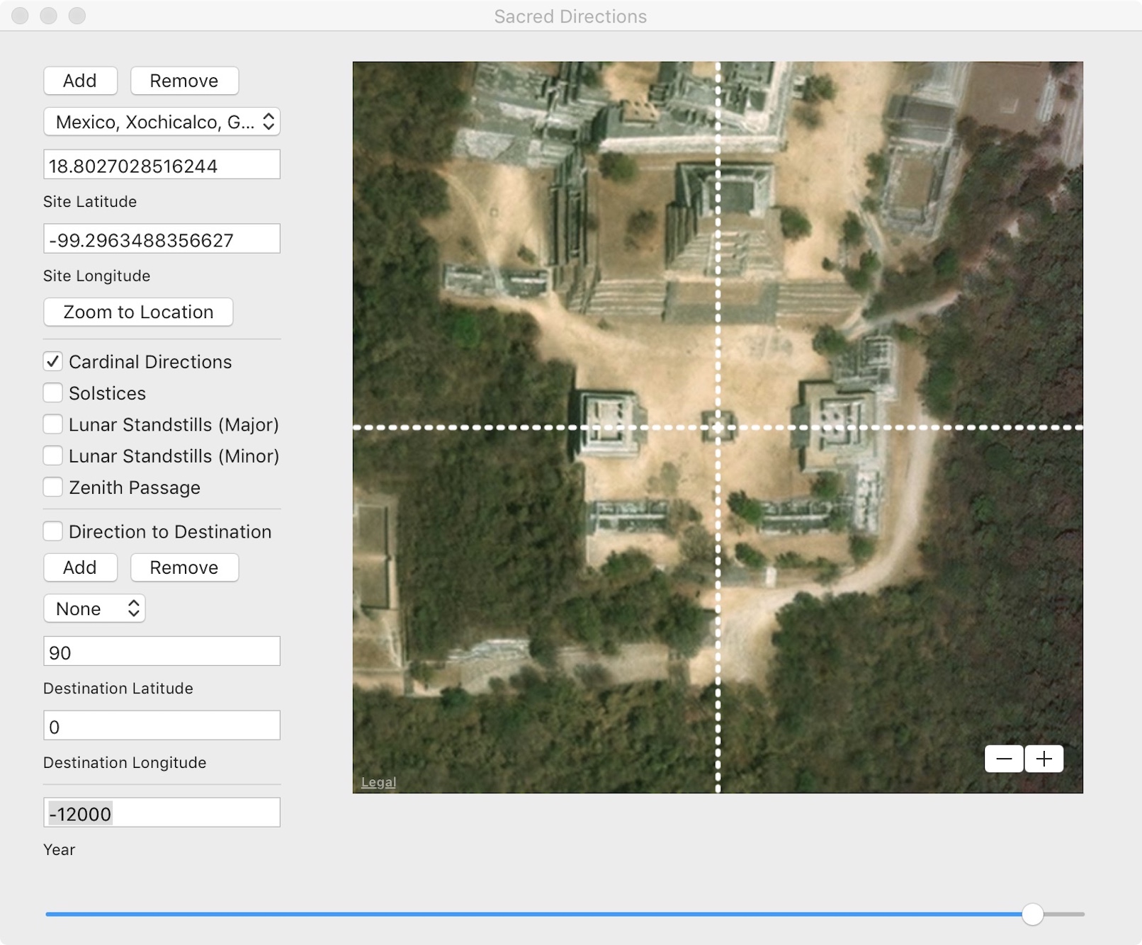
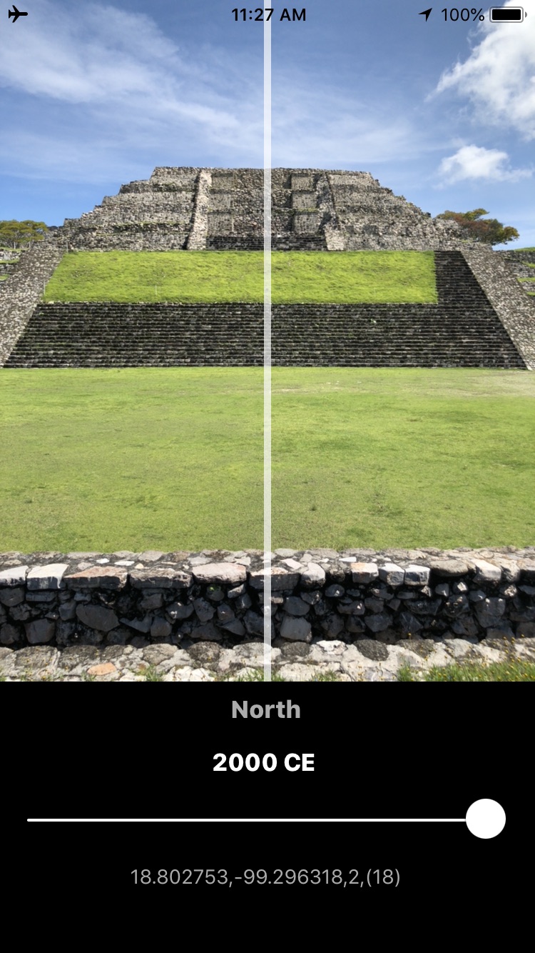
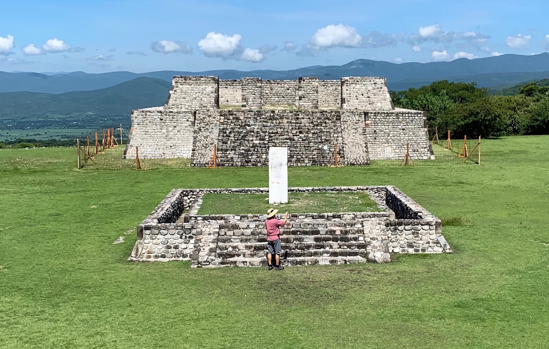
Photo of Plaza of the Two Glyphs looking west (left). Screenshot of AR view of the stela containing the two glyphs with the western pyramid in the background (right).
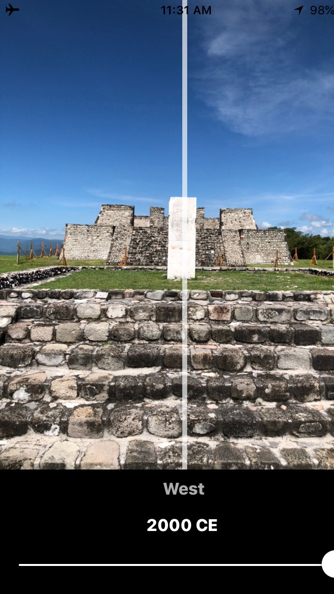
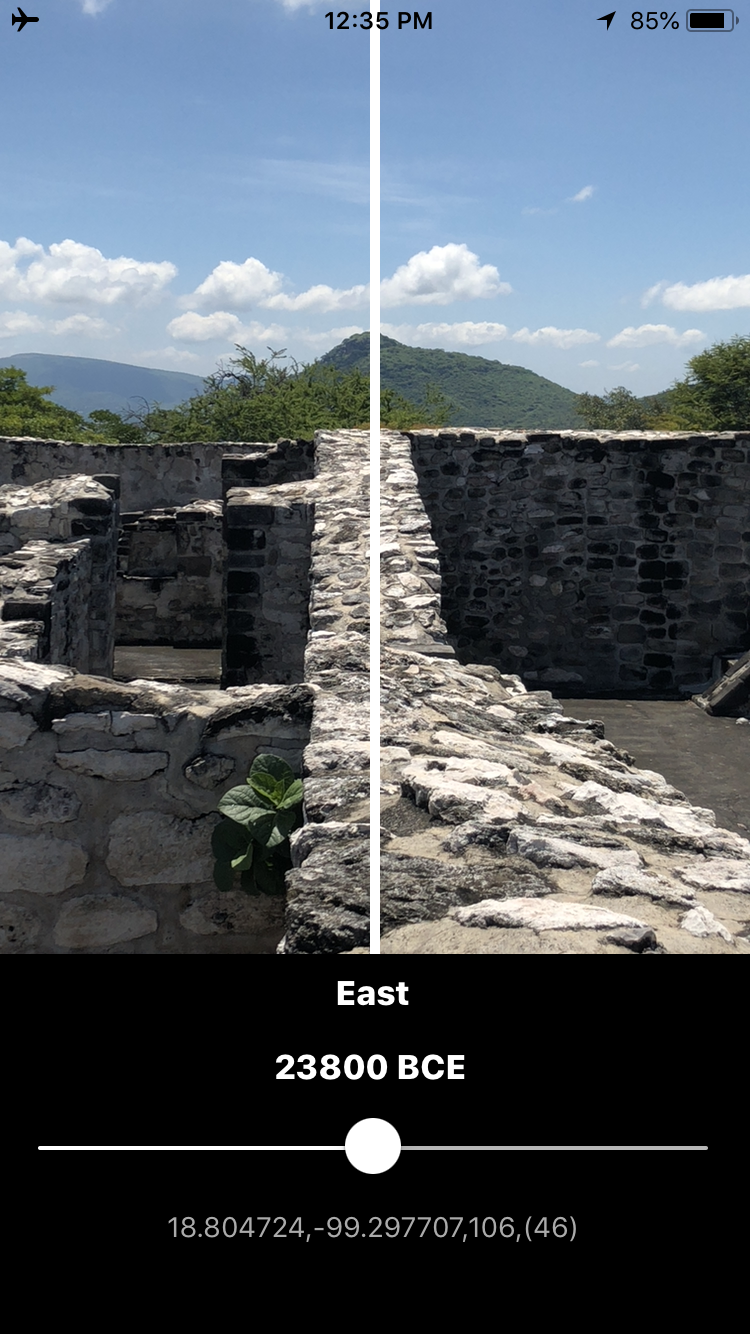
Solstice directions (solid lines) and lunar standstill directions (dotted lines) in the summer (red) and winter (blue) displayed with the Mac OSX app (left). Screenshot of AR view of the winter solstice sunrise at the right (southern edge) of the eastern pyramid (right). Note the orange line in the AR view corresponds to the lower right blue diagonal line that represents the winter solstice sunrise direction.
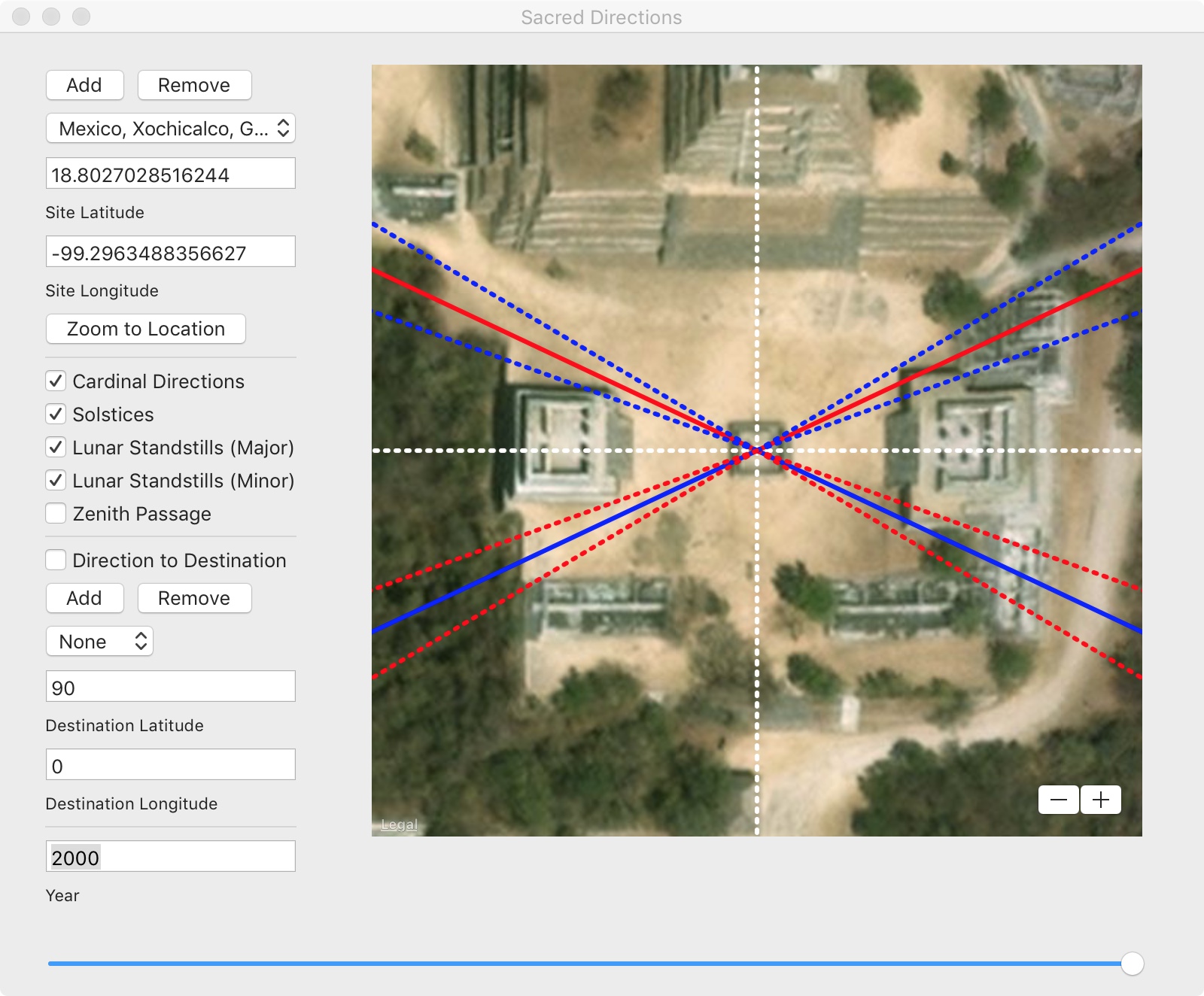

The Grand Pyramid at Xochicalco and structures at the south end of the site are aligned to the cardinal directions. One of many mysteries of Xochicalco is why the northern part of the site is aligned in a different direction. Most ancient structures in Mexico, including those at Xochicalco were built in stages over earlier pre-existing structures. According to a new pole shift hypothesis, it can be shown that if the North Pole were located in Hudson Bay at the time the original structures at this end of the site were built, they would have faced due north. Sacred Directions and Sacred Directions AR both provide a time slider to show how certain alignments change in time as a function of variations in Earth’s obliquity and changes in pole reference. (Click here for more information.)

The Pyramid of the Feathered Serpents (left) and screenshot of AR view of the pyramid from the west.


Photo of a part of the “Acropolis” located east of the Pyramid of the Feathered Serpents (left) and screenshot of AR view along one its walls.

The author wishes to thank Berenice Velazquez for her excellent tour of Xochicalco.

Leave a comment