
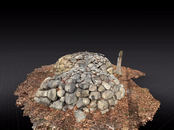
Haskins Park is at the top of Summit Avenue in Rockport. Under a tree, there are two rock piles side by side. Most say they were left behind after the Leander Haskins house which had become a small hospital at the top of Summit Avenue was torn down in the early 20th century. A few believe they are some kind of ancient marker, possibly a burial mound. But, nobody knows for sure.
Nearby Ruins
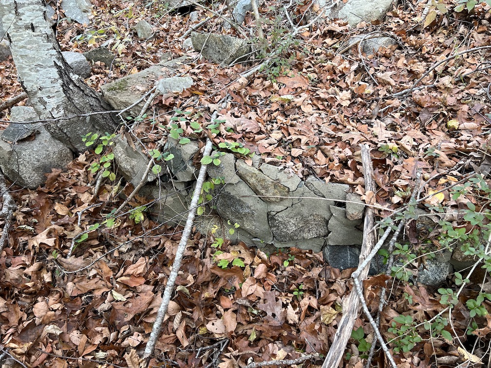
The remains of other structures at the top of Summit Avenue provide a context for evaluating Turtle Rocks.

Between Haskins Park and the water tower are two enormous stone cisterns and other remains of an earlier waterworks.

An old photo of the hospital indicates the building was set on a foundation of cut stone.

The foundation of one of the other structures on the property is like the stone cisterns suggesting that they are from roughly the same period.
Turtle Rocks appear to be field stones roughly fitted to form a cairn. This is consistent with a story I heard that the stones were a memorial to patients who had died at the hospital from typhoid fever. An interesting explanation, but is it correct?


Another Possibility?
On the other side of the Cape, on Pole Hills in Gloucester, there is a megalithic site consisting of a collection of glacial erratics that appeared to have been positioned in such a way as to mark sunrise and sunset directions on the summer and winter solstices. Evidence suggests these stones were part of a Native American ceremonial site that could have been constructed as far back as 4,000 years ago – an estimate based not on direct evidence such as radiocarbon dating of artifacts at the site, but on the alignment of the stones themselves relative to the sun.
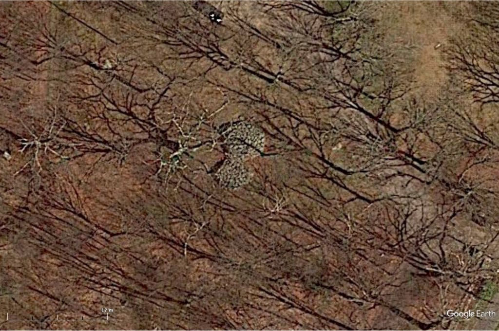
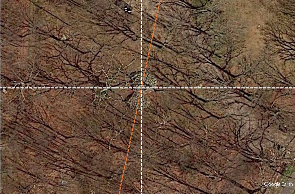
The field of archaeoastronomy assumes ancient people aligned some sites geographically or astronomically and so by analyzing the alignment of a site, it may be possible to date the site. As viewed from above, Turtle Rocks is not oriented along any known geographical or astronomical direction. It is rotated slightly east of north but not enough to be in the direction of the solstices or to extreme northern and southern moonrises and moonsets, known as lunar standstills.
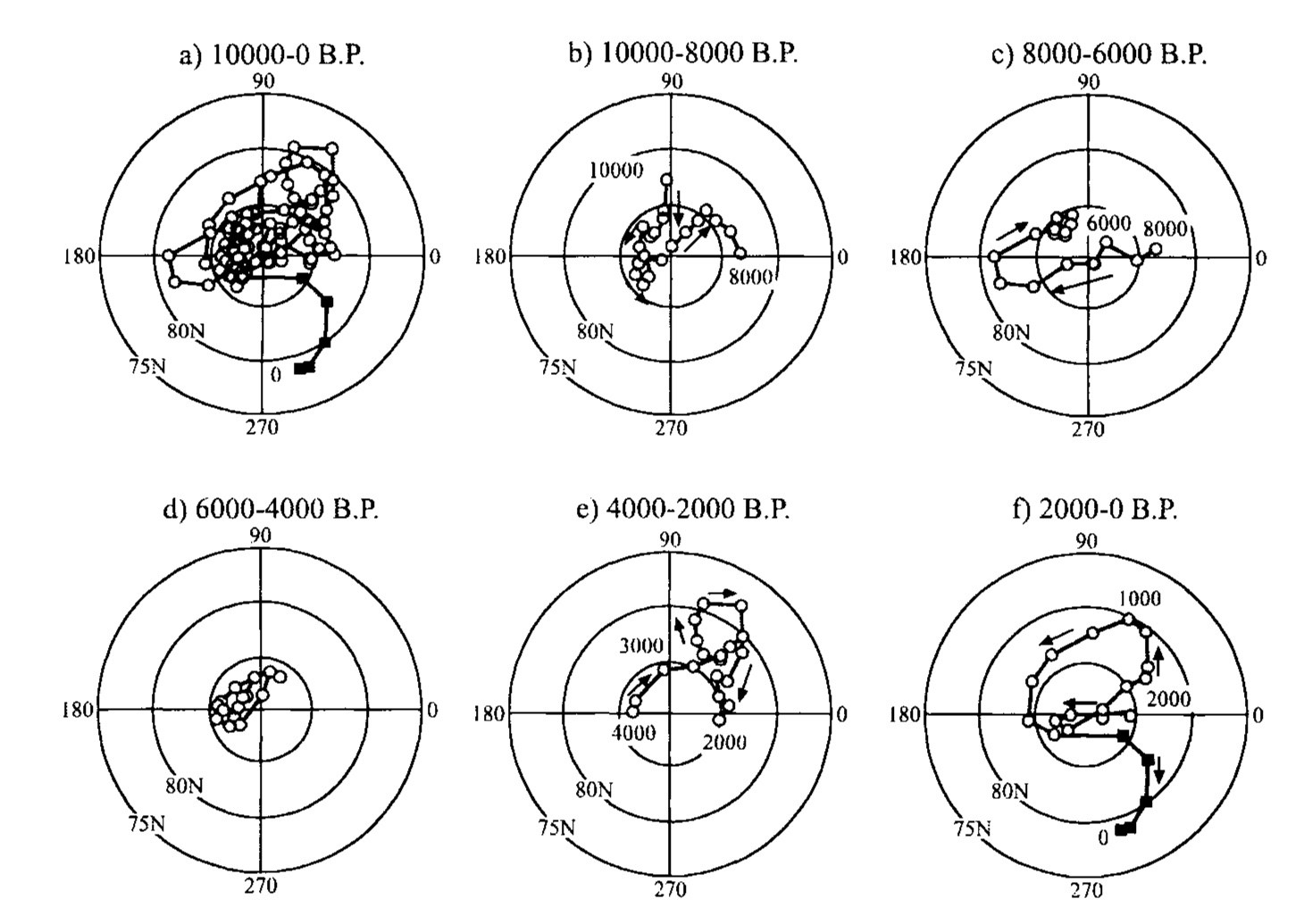
Inspired by some related research, I considered another possibility – that Turtle Rocks was aligned to magnetic north. Knowing the location of the north geomagnetic pole over the past 10,000 years, we can estimate the magnetic declination – the direction a compass would point at Turtle Rocks over this period. Over the past 4,000 years, the best alignment of Turtle Rocks to the pole would have occurred around 700 BCE, more than 2,700 years ago.

A Simpler Explanation
Unlike the astronomical alignments at Poles Hill, the possibility Turtle Rocks was aligned to geomagnetic north at the time of construction is predicated on an unlikely assumption – that a pre-contact civilization possessed a working knowledge of the magnetic compass thousands of years ago here on Cape Ann. As it turned out, there was a simpler explanation. On closer inspection, several of the stones have drill marks on the edges indicating that they were split using stone tools. Another story is that the piles were built by Swedish stonemasons who worked on the property.


Piles of stone not unlike Turtle Rocks exist throughout Sweden. Known as cairns, they often serve as burial mounds or memorials. Perhaps Turtle Rocks was a memorial to those who had died at the hospital after all.
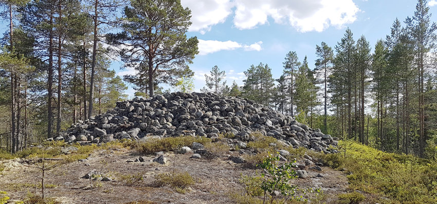
A stone cairn along the coast of northern Sweden.
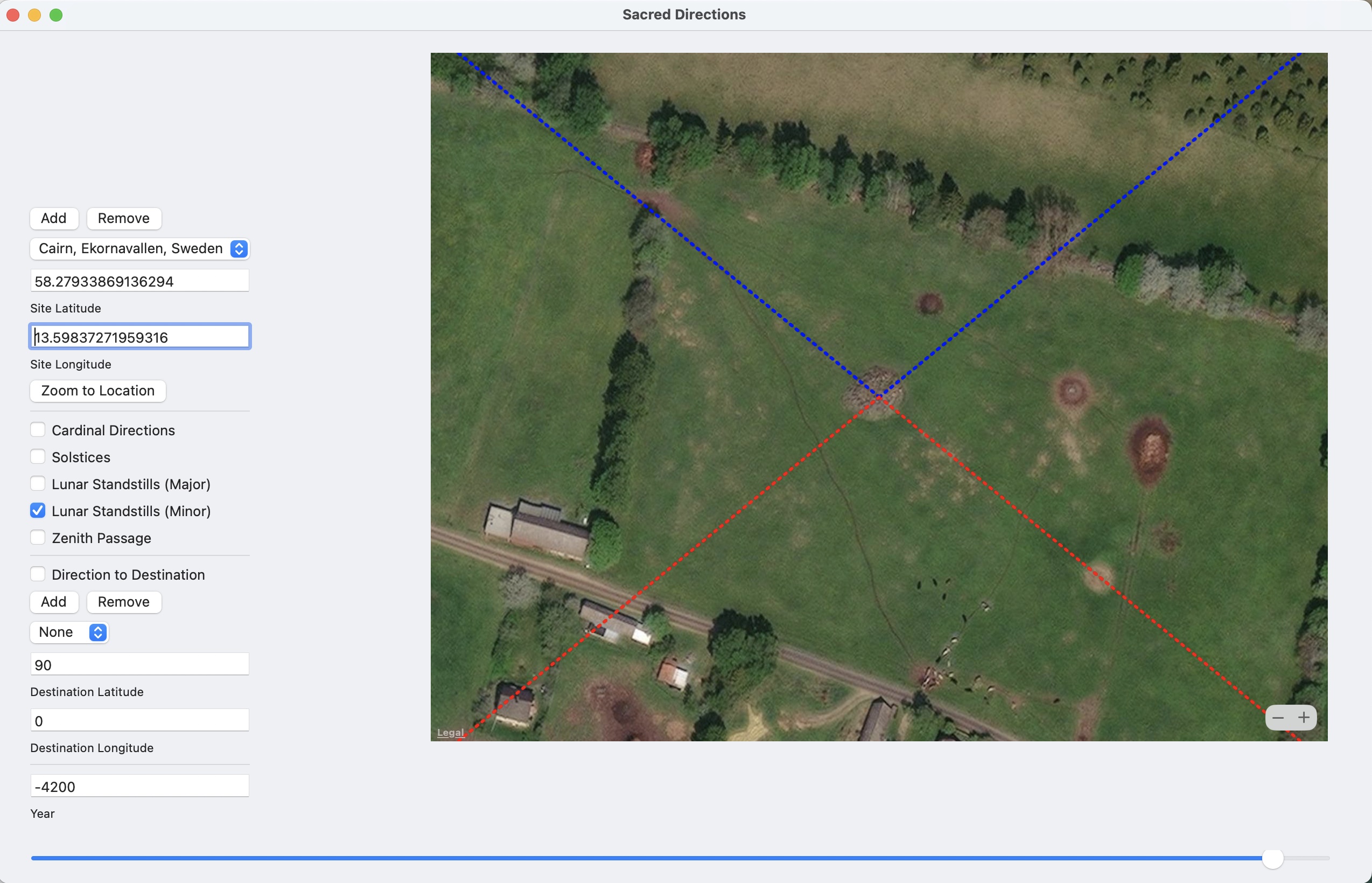
Still, I wonder about its alignment. Many cairns in Europe are astronomically aligned to solstices and lunar standstills. One in Ekornavallen, Sweden appears to have been aligned to minor lunar standstills circa 4200 BCE.
It is possible Turtle Rocks was not purposely aligned to anything. Or, maybe there is another explanation waiting to be discovered.

Leave a comment