Dogtown’s historical and cultural resources were documented in a 2018 survey performed by the Public Archaeology Laboratory as part of the failed National Registry application. Although its natural features were mapped in 1985 under the direction of the Dogtown Steering Committee, Dogtown has never been studied from a remote sensing perspective.
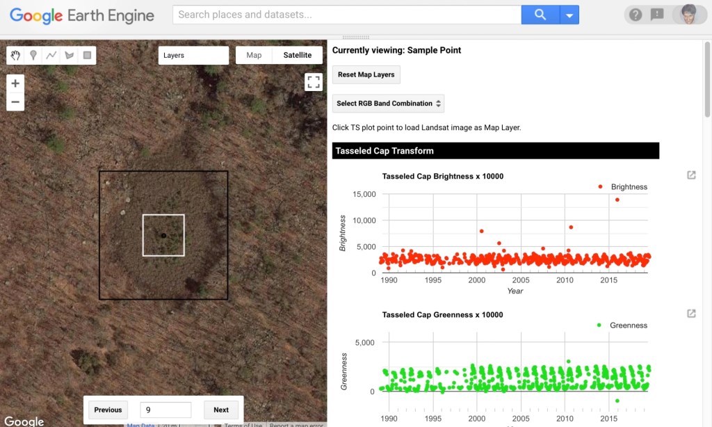
Valerie Pasquarella and colleagues at Boston University describe how an extensive archive of Landsat satellite data over the past three-plus decades can be used to understand relationships between time-series data, ecosystems and ecological processes.
Much of what we know about Dogtown’s people was passed down in oral histories captured in Charles Mann’s The Story of Dogtown. Inspired by Pasquarella’s research, a preliminary study of selected areas in Dogtown was performed for the purpose of characterizing and comparing vegetation changes in Dogtown – in effect to begin to tell today’s ecological “story” of Dogtown from a remote sensing perspective.

Leave a comment