
Fitz Henry Lane’s The Babson Meadows at Riverdale depicts an open pastoral landscape long since lost to residential development and expansion. Lane’s 1863 painting captures a number of historical landmarks including the Riverdale Methodist Church on Washington Street, the Riggs School, torn down in the 1950s, Riverdale Mills, now a convenience store, and Poles Hill.
Dr. Babson’s Flagpole
Sitting at the highest spot on Poles Hill was a tower or more precisely a flagstaff erected in 1861 after the capture of Fort Sumter at the start of America’s Civil War (Gloucester Daily Times, April 18, 1894). I first learned of this feature later known as Dr. Babson’s flagpole while researching solar alignments on Poles Hill in 2014. The bolts and holes that served to anchor the structure, which was at least as tall as the hill – over 120 feet in height are all that remain today.


Squam Rock
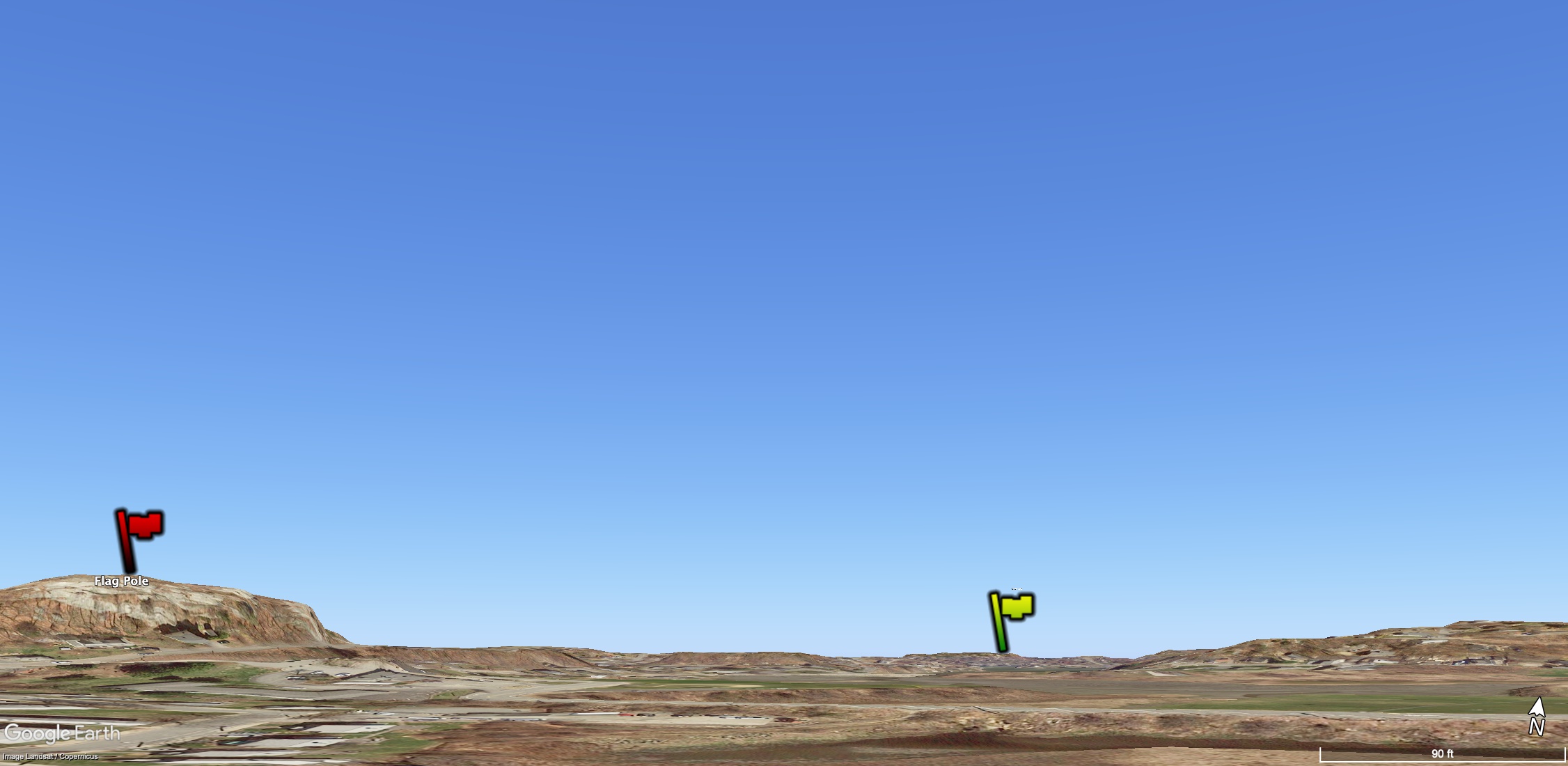
What is interesting is that a close inspection of the horizon to the north in the Lane painting reveals another tower faintly visible in the distance. On a walk with my wife across Annisquam in the fall of 2017, I noticed twisted and rusted metalwork on the side of Squam Rock. Placing a virtual flagpole here and at Poles Hill one is able to generate a ground view using Google Earth that matches the approximate locations of the two structures in the Lane painting.

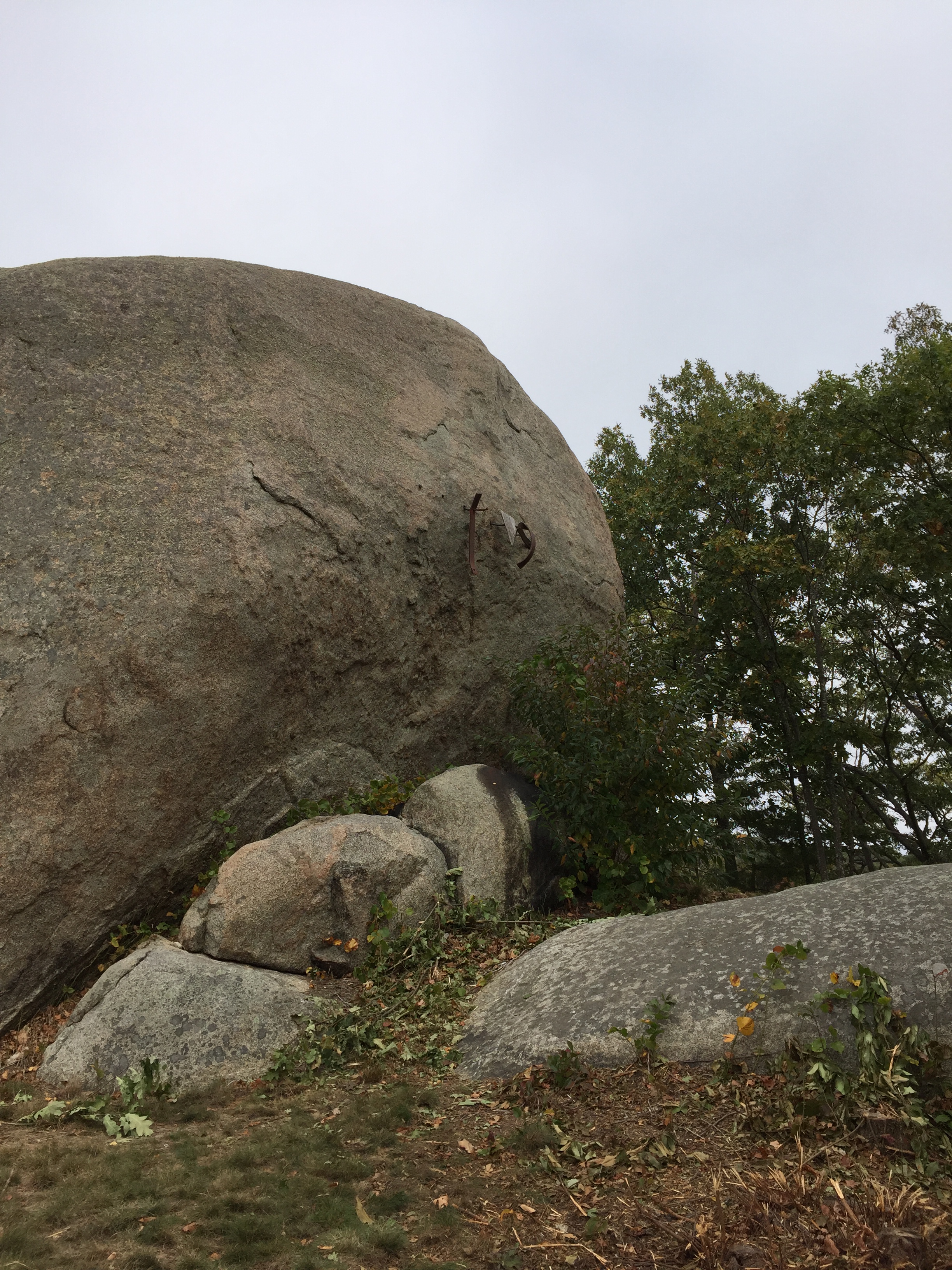

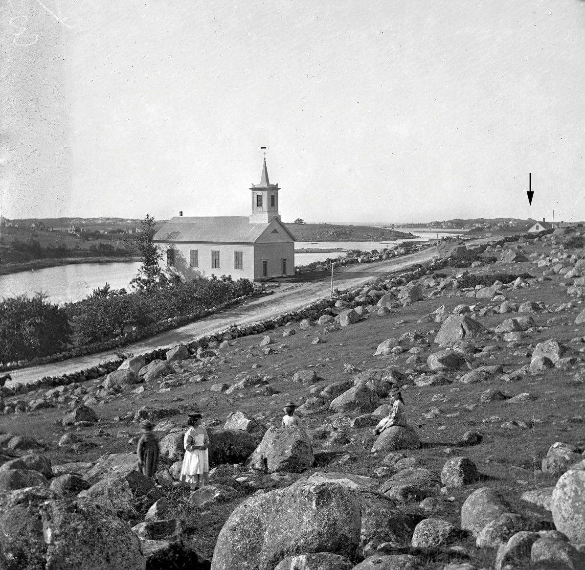
Was a second flagstaff erected in Annisquam at around the same time? An online version of a photo looking north toward the Riverdale Methodist church from around 1870 suggests that it could have been there. Perhaps clearer indication can be found in the original photograph by E. G. Rollins in the Cape Ann Museum archives.
Another Tower?
I learned about another unidentified tower seen in an early 20th-century photograph of Poles Hill by my neighbor Bill Noble. The photo taken by Alice Curtis appears to show a smaller tower to the north. Bill believed the two towers served as some kind of navigational aid.

In 2021 my friend Chuck and I found a rock at the northern end of Poles Hill with several iron rods sticking up out of it that could have anchored some kind of structure. Placing a marker at this location one can generate a Google Earth rendering that matches the general position of the two poles.


The azimuth of the line between the two poles is about 35 degrees west of north. This heading does not appear to have any significance. Too far to the west to be aligned to magnetic north or to point toward anything of interest, the reason for this second pole remains a mystery.

Leave a comment